Fort Worth

FortWorthWeekly.news — Western roots. Neighborhood news for modern Fort Worth.

Back to Weather

5-day forecast / Fort Worth, TX

FridayShowers And Thunderstorms Likely78° / 69° 59%
SaturdayShowers And Thunderstorms Likely77° / 68° 61%
SundayChance Rain Showers then Partly Sunny82° / 66° 27%
MondaySunny83° / 62°
TuesdaySunny83° / 61°

Flood Watch in Effect for Fort Worth as Humid Showers Approach - Oct 2, 2 PM

Fort Worth weather, updated every four hours — local forecasts you can trust.

A severe Flood Watch is active for Fort Worth. Conditions are quite humid with a dew point of 70F, and showers with thunderstorms are likely today and tomorrow.

Tessa Whitlock

October 2, 20262 min read

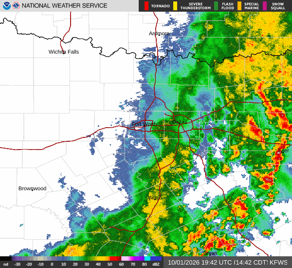
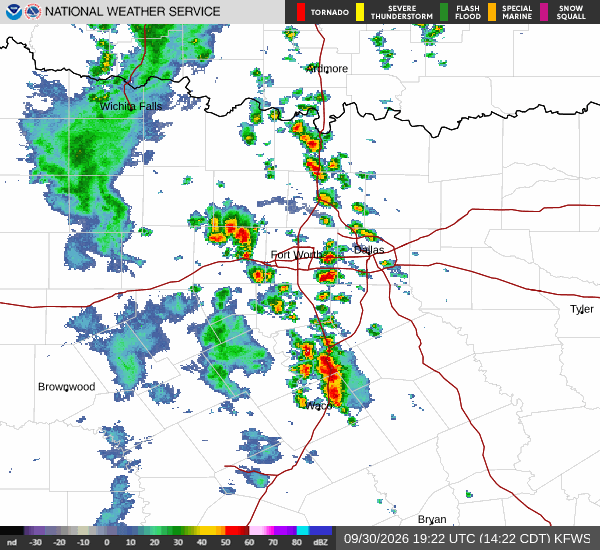
National Weather Service radar for North Texas (KFWS)

*As of Oct 2, 2 PM local time.*

Active Alert and Current Conditions

A Flood Watch with severe severity and future urgency is currently in effect for Fort Worth. This alert was issued by the National Weather Service in Fort Worth, Texas, and remains active until October 2 at 7:00PM CDT.

Right now on Friday afternoon, the air temperature stands at 79F, though it feels like 80F due to the moisture in the air. The relative humidity is at 74%, with a dew point of 70F, indicating quite humid conditions. Winds are blowing from the north northeast at 11 mph, with gusts reaching up to 17 mph.

The sky remains cloudy as we move through this period.

Forecast for Today and Tonight

The National Weather Service indicates that showers and thunderstorms are likely today. Expect mostly cloudy skies with a high near 78F. Winds will be from the north northeast around 10 mph, with gusts as high as 20 mph. The chance of precipitation is 70%. Residents should anticipate new rainfall amounts between a half and three quarters of an inch possible during this period.

Tonight, conditions remain cloudy with showers and thunderstorms likely. Temperatures will drop to a low around 69F. Winds will ease slightly to the north northeast at 5 to 10 mph. The chance of precipitation is 60%, with another half to three quarters of an inch of rain possible.
Outlook for Tomorrow

Tomorrow, showers and thunderstorms are likely again under cloudy skies. The high will be near 77F, with north northeast winds around 5 mph. There is a 60% chance of precipitation, and new rainfall amounts between a quarter and half of an inch are possible.

Looking ahead to tomorrow night, there is a chance of showers and thunderstorms with mostly cloudy skies. Temperatures will fall to a low around 68F, though they may rise to around 70F overnight. Winds will remain light at the north northeast around 5 mph. The chance of precipitation drops to 30%, with less than a tenth of an inch of rain possible.

Safety Reminder

Given the active Flood Watch and the likelihood of significant rainfall, please monitor local news for updates. Ensure you have safe shelter options identified if flooding occurs. Stay hydrated as humidity levels remain high, and limit midday exertion if temperatures feel elevated.

National Weather Service radar for North Texas (KFWS)

Sources

National Weather Service radar

National Weather Service forecast data

Open-Meteo weather data

Share

Tessa Whitlock

Tessa Whitlock covers weather, storms, and seasonal life around Fort Worth.

Related Stories

More in Sport